当前位置:
X-MOL 学术
›
Remote Sens. Ecol. Conserv.
›
论文详情
Our official English website, www.x-mol.net, welcomes your feedback! (Note: you will need to create a separate account there.)
Selection in the third dimension: Using LiDAR derived canopy metrics to assess individual and population-level habitat partitioning of ocelots, bobcats, and coyotes
Remote Sensing in Ecology and Conservation ( IF 5.5 ) Pub Date : 2023-11-15 , DOI: 10.1002/rse2.369 Maksim Sergeyev 1 , Daniel A. Crawford 1 , Joseph D. Holbrook 2 , Jason V. Lombardi 1 , Michael E. Tewes 1 , Tyler A. Campbell 3
Remote Sensing in Ecology and Conservation ( IF 5.5 ) Pub Date : 2023-11-15 , DOI: 10.1002/rse2.369 Maksim Sergeyev 1 , Daniel A. Crawford 1 , Joseph D. Holbrook 2 , Jason V. Lombardi 1 , Michael E. Tewes 1 , Tyler A. Campbell 3
Affiliation
|
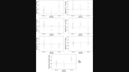
Wildlife depends on specific landscape features to persist. Thus, characterizing the vegetation available in an area can be essential for management. The ocelot (Leopardus pardalis) is a federally endangered, medium-sized felid adapted to woody vegetation. Quantifying the characteristics of vegetation most suitable for ocelots is essential for their conservation. Furthermore, understanding differences in the selection of sympatric bobcats (Lynx rufus) and coyotes (Canis latrans) can provide insight into the mechanisms of coexistence between species. Because of differences in hunting strategy (cursorial vs. ambush) and differences in use of land cover types between species, these three carnivores may be partitioning their landscape as a function of vegetation structure. Light detection and ranging (LiDAR) is a remote sensing platform capable of quantifying the sub-canopy structure of vegetation. Using LiDAR data, we quantified the horizontal and vertical structure of vegetation cover to assess habitat selection by ocelots, bobcats, and coyotes. We captured and collared 8 ocelots, 13 bobcats, and 5 coyotes in southern Texas from 2017 to 2021. We used step selection functions to determine the selection of vegetation cover at the population and individual level for each species. Ocelots selected for vertical canopy cover and dense vegetation 0–2 m in height. Bobcats selected cover to a lesser extent and had a broader selection, while coyotes avoided under-story vegetation and selected areas with dense high canopies and relatively open understories. We observed a high degree of variation among individuals that may aid in facilitating intraspecific and interspecific coexistence. Management for ocelots should prioritize vegetation below 2 m and vertical canopy cover. We provide evidence that fine-scale habitat partitioning may facilitate coexistence between sympatric carnivores. Differences among individuals may enhance coexistence among species, as increased behavioral plasticity of individuals can reduce competition for resources. By combining accurate, fine-scale measurements derived from LiDAR data with high-frequency global positioning system locations, we provide a more thorough understanding of the habitat use of ocelots and two sympatric carnivores.
中文翻译:

第三维度的选择:使用 LiDAR 导出的冠层指标来评估豹猫、山猫和土狼的个体和种群水平栖息地划分
野生动物依赖于特定的景观特征来生存。因此,描述一个地区可用植被的特征对于管理至关重要。豹猫(Leopardus pardalis)是一种联邦濒临灭绝的中型猫科动物,适应木本植被。量化最适合豹猫生存的植被特征对于保护豹猫至关重要。此外,了解同域山猫( Lynx rufus)和土狼(Canis latrans )选择的差异可以帮助深入了解物种之间的共存机制。由于狩猎策略的差异(光标与伏击)以及物种间土地覆盖类型使用的差异,这三种食肉动物可能会根据植被结构来划分其景观。光探测和测距(LiDAR)是一种能够量化植被亚冠层结构的遥感平台。使用激光雷达数据,我们量化了植被覆盖的水平和垂直结构,以评估豹猫、山猫和土狼的栖息地选择。2017 年至 2021 年,我们在德克萨斯州南部捕获了 8 只豹猫、13 只山猫和 5 只郊狼,并给它们戴上项圈。我们使用步骤选择函数来确定每个物种在种群和个体水平上的植被覆盖选择。选择豹猫的原因是垂直的树冠覆盖和高度为 0-2 m 的茂密植被。山猫选择的覆盖范围较小,选择范围更广,而郊狼则避开林下植被,选择具有茂密高树冠和相对开放的林下植被的区域。我们观察到个体之间存在高度差异,这可能有助于促进种内和种间共存。对豹猫的管理应优先考虑 2 m 以下的植被和垂直树冠覆盖。我们提供的证据表明,精细的栖息地划分可能有助于同域食肉动物之间的共存。个体之间的差异可能会增强物种之间的共存,因为个体行为可塑性的增加可以减少对资源的竞争。通过将激光雷达数据的精确、精细测量与高频全球定位系统位置相结合,我们可以更全面地了解豹猫和两种同域食肉动物的栖息地利用情况。
更新日期:2023-11-16
中文翻译:
第三维度的选择:使用 LiDAR 导出的冠层指标来评估豹猫、山猫和土狼的个体和种群水平栖息地划分
野生动物依赖于特定的景观特征来生存。因此,描述一个地区可用植被的特征对于管理至关重要。豹猫(Leopardus pardalis)是一种联邦濒临灭绝的中型猫科动物,适应木本植被。量化最适合豹猫生存的植被特征对于保护豹猫至关重要。此外,了解同域山猫( Lynx rufus)和土狼(Canis latrans )选择的差异可以帮助深入了解物种之间的共存机制。由于狩猎策略的差异(光标与伏击)以及物种间土地覆盖类型使用的差异,这三种食肉动物可能会根据植被结构来划分其景观。光探测和测距(LiDAR)是一种能够量化植被亚冠层结构的遥感平台。使用激光雷达数据,我们量化了植被覆盖的水平和垂直结构,以评估豹猫、山猫和土狼的栖息地选择。2017 年至 2021 年,我们在德克萨斯州南部捕获了 8 只豹猫、13 只山猫和 5 只郊狼,并给它们戴上项圈。我们使用步骤选择函数来确定每个物种在种群和个体水平上的植被覆盖选择。选择豹猫的原因是垂直的树冠覆盖和高度为 0-2 m 的茂密植被。山猫选择的覆盖范围较小,选择范围更广,而郊狼则避开林下植被,选择具有茂密高树冠和相对开放的林下植被的区域。我们观察到个体之间存在高度差异,这可能有助于促进种内和种间共存。对豹猫的管理应优先考虑 2 m 以下的植被和垂直树冠覆盖。我们提供的证据表明,精细的栖息地划分可能有助于同域食肉动物之间的共存。个体之间的差异可能会增强物种之间的共存,因为个体行为可塑性的增加可以减少对资源的竞争。通过将激光雷达数据的精确、精细测量与高频全球定位系统位置相结合,我们可以更全面地了解豹猫和两种同域食肉动物的栖息地利用情况。


 京公网安备 11010802027423号